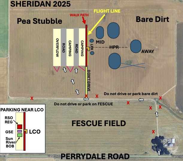
The location for the 2025 Filible’s Folly is now known! And it’s one we haven’t used in well over a decade… that will bring with it a slightly different field layout, and a request from the land owner: DO NOT DRIVE IN THE FIELDS, with a specific exception we’ll talk about later. So with that understanding…
Where are we flying from?
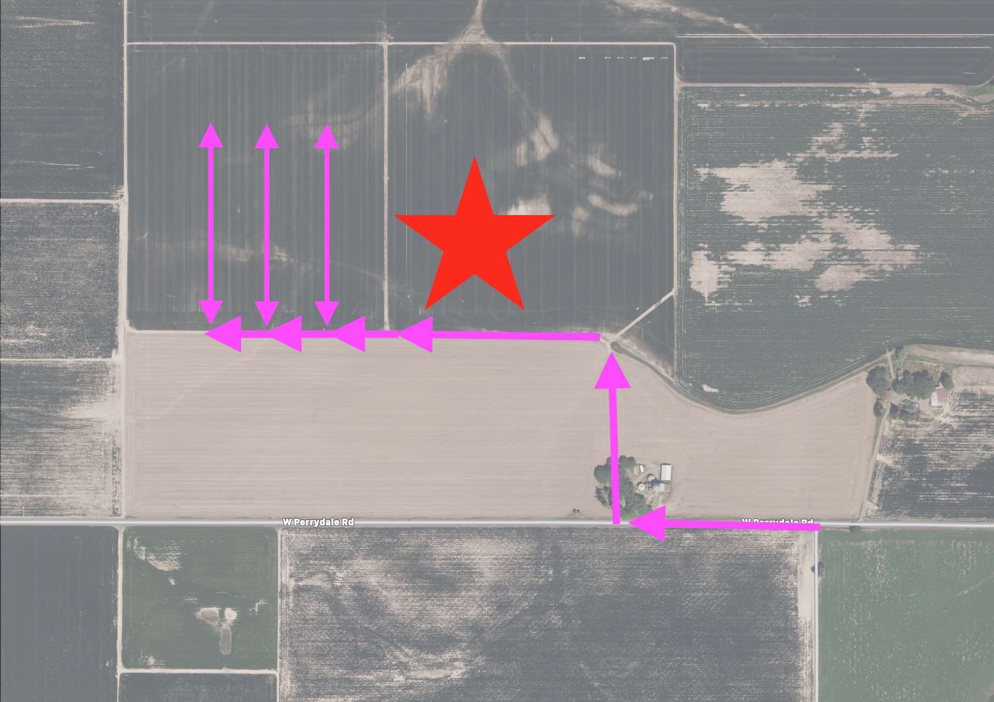
Once you are in the normal launch area, to get to the field, you’ll turn north off of West Perrydale road at the dirt road by “the silos” and proceed about 1000 feet north where the road bends to the left, then proceed to the west 1400 feet or so and you’re there! Remember: do not drive in the fields and keep your speed under 5 mph on the dirt road. See the normal Sheridan page for directions to get there if you are unfamiliar.
So what’s different about the layout?
Instead of the usual North to South layout, we’ll be laying the site out East to West this year. In the layout map above there are three fields which are relevant to this year’s launch. They are:
- On the north side of the dirt road, there are two smaller fields, both of which are dark grey in the satellite map above.
- To the east side, where the big star is drawn, is a freshly plowed field ready for planting. This is where we will be flying from. DO NOT DRIVE ON THIS FIELD.
- To the west side, is a field of pea stubble. This is where we will be parking and camping, this is also where all the prep areas and LCO/FSO/Registration will be located. You can drive on this field, we will have a couple of “roads” marked off between the blocks of camping which run North to South, perpendicular to dirt road.
- The road between these two fields will be used as the walking path along the flight line, just like we have at brothers, please do not drive on this road or set anything up in it.
- On the south side of the dirt road (between the dirt road and Perrydale road) is a field of Fescue grass. In the satellite map above this field is light tan. DO NOT DRIVE ON THIS FIELD, other than to pull off onto the edge of it to allow cars going the other direction to pass.